A | B | C | D | E | F | G | H | CH | I | J | K | L | M | N | O | P | Q | R | S | T | U | V | W | X | Y | Z | 0 | 1 | 2 | 3 | 4 | 5 | 6 | 7 | 8 | 9
Hubbard County | |
|---|---|
 The historic Hubbard County Courthouse in Park Rapids | |
 Location within the U.S. state of Minnesota | |
 Minnesota's location within the U.S. | |
| Coordinates: 47°06′N 94°55′W / 47.1°N 94.91°W | |
| Country | |
| State | |
| Founded | February 26, 1883[1] |
| Named for | Lucius Frederick Hubbard |
| Seat | Park Rapids |
| Largest city | Park Rapids |
| Area | |
| • Total | 999.39 sq mi (2,588.4 km2) |
| • Land | 922.46 sq mi (2,389.2 km2) |
| • Water | 76.93 sq mi (199.2 km2) 7.70% |
| Population (2020) | |
| • Total | 21,344 |
| • Estimate (2023) | 22,132 |
| • Density | 23.1/sq mi (8/km2) |
| Time zone | UTC−6 (Central) |
| • Summer (DST) | UTC−5 (CDT) |
| Congressional district | 8th |
| Website | www |
Hubbard County is a county in the northwestern part of the U.S. state of Minnesota. As of the 2020 census, the population was 21,344.[2] Its county seat is Park Rapids.[3]
Part of the Leech Lake Indian Reservation is in the county.
History
The county was created on February 26, 1883, with territory partitioned from Cass County. It was named for Lucius Frederick Hubbard, a prominent Territory editor, Civil War participant, and businessman who was governor of Minnesota from 1882 to 1887.[4][5] The county's boundaries have remained unchanged since its creation.
The new county's courthouse was destroyed by fire around 1890, but the public records were salvaged.
Geography
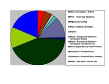
The county's terrain is hilly, largely wooded, and dotted with lakes and ponds.[6] It generally slopes to the east, with the northern part sloping to the north and the southern part sloping to the south. Its highest point is near the lower middle of its western border, at 1,549 ft (472 m) ASL.[7] The county has an area of 1,000 square miles (2,600 km2), of which 926 square miles (2,400 km2) is land and 74 square miles (190 km2) (7.4%) is water. There may be such a high point on the border but the accepted high point for this county is the Thorpe Lookout at 1844 feet which is why the forest service maintains a tower there the US Geodetic Survey agrees.47.0962°N, -94.8539° W[8]
Major highways
Adjacent counties
- Beltrami County - north
- Cass County - east
- Wadena County - south
- Becker County - southwest
- Clearwater County - northwest
Protected areas
Source:[6]
- Badoura Jack Pine Woodland Scientific and Natural Area
- Huntersville State Forest (part)
- Itasca State Park (part)
- Mississippi Headwaters (part)
- Paul Bunyan State Forest (part)
Demographics
| Census | Pop. | Note | %± |
|---|---|---|---|
| 1890 | 1,412 | — | |
| 1900 | 6,578 | 365.9% | |
| 1910 | 9,831 | 49.5% | |
| 1920 | 10,136 | 3.1% | |
| 1930 | 9,596 | −5.3% | |
| 1940 | 11,085 | 15.5% | |
| 1950 | 11,085 | 0.0% | |
| 1960 | 9,962 | −10.1% | |
| 1970 | 10,583 | 6.2% | |
| 1980 | 14,098 | 33.2% | |
| 1990 | 14,939 | 6.0% | |
| 2000 | 18,376 | 23.0% | |
| 2010 | 20,428 | 11.2% | |
| 2020 | 21,344 | 4.5% | |
| 2023 (est.) | 22,132 | [10] | 3.7% |
| U.S. Decennial Census[11] 1790-1960[12] 1900-1990[13] 1990-2000[14] 2010-2020[2] | |||
2020 Census
| Race | Num. | Perc. |
|---|---|---|
| White (NH) | 19,139 | 89.7% |
| Black or African American (NH) | 82 | 0.4% |
| Native American (NH) | 560 | 2.62% |
| Asian (NH) | 66 | 0.31% |
| Pacific Islander (NH) | 12 | 0.05% |
| Other/Mixed (NH) | 996 | 4.7% |
| Hispanic or Latino | 489 | 2.3% |
2000 census

As of the census of 2000, there were 18,376 people, 7,435 households, and 5,345 families in the county. The population density was 19.9 per square mile (7.7/km2). There were 12,229 housing units at an average density of 13.3 per square mile (5.1/km2). The racial makeup of the county was 96.31% White, 0.17% Black or African American, 2.13% Native American, 0.27% Asian, 0.01% Pacific Islander, 0.22% from other races, and 0.89% from two or more races. 0.67% of the population were Hispanic or Latino of any race. 35.0% were of German, 20.5% Norwegian, 6.0% English and 5.8% Swedish ancestry.
There were 7,435 households, out of which 29.30% had children under the age of 18 living with them, 61.10% were married couples living together, 7.10% had a female householder with no husband present, and 28.10% were non-families. 24.20% of all households were made up of individuals, and 11.30% had someone living alone who was 65 years of age or older. The average household size was 2.45 and the average family size was 2.88.
The county population contained 24.60% under the age of 18, 6.40% from 18 to 24, 24.10% from 25 to 44, 26.90% from 45 to 64, and 18.00% who were 65 years of age or older. The median age was 42 years. For every 100 females there were 99.90 males. For every 100 females age 18 and over, there were 98.00 males.
The median income for a household in the county was $35,321, and the median income for a family was $41,177. Males had a median income of $30,030 versus $21,616 for females. The per capita income for the county was $18,115. 9.70% of the population and 7.50% of families were below the poverty line. 12.50% of those under the age of 18 and 9.30% of those 65 and older were living below the poverty line.
Communities
Cities

Census-designated places
Unincorporated communities
Source:[6]
Townships
- Akeley Township
- Arago Township
- Badoura Township
- Clay Township
- Clover Township
- Crow Wing Lake Township
- Farden Township
- Fern Township
- Guthrie Township
- Hart Lake Township
- Helga Township
- Hendrickson Township
- Henrietta Township
- Hubbard Township
- Lake Alice Township
- Lake Emma Township
- Lake George Township
- Lake Hattie Township
- Lakeport Township
- Mantrap Township
- Nevis Township
- Rockwood Township
- Schoolcraft Township
- Steamboat River Township
- Straight River Township
- Thorpe Township
- Todd Township
- White Oak Township
Government and politics
Hubbard County voters have leaned toward the Republican Party for several decades. As of 2020 the county has selected the Republican candidate in 78% of presidential elections since 1980.
| Year | Republican | Democratic | Third party | |||
|---|---|---|---|---|---|---|
| No. | % | No. | % | No. | % | |
| 2020 | 8,202 | 63.26% | 4,462 | 34.42% | 301 | 2.32% |
| 2016 | 7,261 | 63.11% | 3,423 | 29.75% | 821 | 7.14% |
| 2012 | 6,622 | 57.48% | 4,676 | 40.59% | 222 | 1.93% |
| 2008 | 6,558 | 56.35% | 4,872 | 41.86% | 208 | 1.79% |
| 2004 | 6,444 | 56.83% | 4,741 | 41.81% | 155 | 1.37% |
| 2000 | 5,307 | 55.21% | 3,632 | 37.78% | 674 | 7.01% |
| 1996 | 3,593 | 41.25% | 3,802 | 43.65% | 1,316 | 15.11% |
| 1992 | 3,227 | 37.57% | 3,362 | 39.14% | 2,000 | 23.29% |
| 1988 | 4,365 | 56.42% | 3,306 | 42.74% | 65 | 0.84% |
| 1984 | 4,621 | 61.76% | 2,806 | 37.50% | 55 | 0.74% |
| 1980 | 4,172 | 55.53% | 2,840 | 37.80% | 501 | 6.67% |
| 1976 | 2,985 | 46.00% | 3,196 | 49.25% | 308 | 4.75% |
| 1972 | 3,294 | 59.31% | 2,136 | 38.46% | 124 | 2.23% |
| 1968 | 2,720 | 54.95% | 1,920 | 38.79% | 310 | 6.26% |
| 1964 | 2,283 | 47.14% | 2,553 | 52.72% | 7 | 0.14% |
| 1960 | 2,749 | 57.43% | 2,029 | 42.39% | 9 | 0.19% |
| 1956 | 2,453 | 62.69% | 1,454 | 37.16% | 6 | 0.15% |
| 1952 | 3,099 | 68.97% | 1,360 | 30.27% | 34 | 0.76% |
| 1948 | 2,071 | 48.83% | 2,044 | 48.20% | 126 | 2.97% |
| 1944 | 2,114 | 56.52% | 1,613 | 43.13% | 13 | 0.35% |
| 1940 | 2,544 | 54.00% | 2,141 | 45.45% | 26 | 0.55% |
| 1936 | 1,618 | 39.83% | 2,312 | 56.92% | 132 | 3.25% |
| 1932 | 1,349 | 35.96% | 2,230 | 59.45% | 172 | 4.59% |
| 1928 | 2,291 | 65.76% | 1,120 | 32.15% | 73 | 2.10% |
| 1924 | 1,884 | 57.81% | 191 | 5.86% | 1,184 | 36.33% |
| 1920 | 2,238 | 73.84% | 453
Zdroj:https://en.wikipedia.org?pojem=Hubbard_County,_Minnesota >Text je dostupný pod licencí Creative Commons Uveďte autora – Zachovejte licenci, případně za dalších podmínek. Podrobnosti naleznete na stránce Podmínky užití. čítajte viac o Hubbard_County,_Minnesota
Text je dostupný za podmienok Creative
Commons Attribution/Share-Alike License 3.0 Unported; prípadne za ďalších
podmienok. | |||

