A | B | C | D | E | F | G | H | CH | I | J | K | L | M | N | O | P | Q | R | S | T | U | V | W | X | Y | Z | 0 | 1 | 2 | 3 | 4 | 5 | 6 | 7 | 8 | 9
This article needs additional citations for verification. (October 2016) |
Jōetsu
上越市 | |||||||
|---|---|---|---|---|---|---|---|
    
| |||||||
 Flag  Seal | |||||||
 Location of Jōetsu in Niigata | |||||||
 Jōetsu | |||||||
| Coordinates: 37°8′52.3″N 138°14′9.9″E / 37.147861°N 138.236083°E | |||||||
| Country | Japan | ||||||
| Region | Chūbu (Kōshin'etsu) (Hokuriku) | ||||||
| Prefecture | Niigata | ||||||
| First official recorded | 702 AD | ||||||
| Takada city established | September 1, 1911 | ||||||
| Naoetsu city established | June 1, 1954 | ||||||
| Two cities merged and current name date | April 30, 1971 | ||||||
| Government | |||||||
| • Mayor | Hideyuki Murayama | ||||||
| Area | |||||||
| • Total | 973.81 km2 (375.99 sq mi) | ||||||
| Population (December 1, 2020) | |||||||
| • Total | 189,430 | ||||||
| • Density | 190/km2 (500/sq mi) | ||||||
| Time zone | UTC+9 (Japan Standard Time) | ||||||
| Phone number | 025-526-5111 | ||||||
| Address | 1-1-3 Kida, Jōetsu-shi, Niigata-ken 943-8601 | ||||||
| Climate | Cfa | ||||||
| Website | Official website | ||||||
| Symbols | |||||||
| Flower | Camellia | ||||||
| Tree | Sakura | ||||||


Jōetsu (上越市, Jōetsu-shi) is a city located in Niigata Prefecture, Japan. As of 1 December 2020[update], the city had an estimated population of 189,430, in 76,461 households[1] with a population density of 190 persons per km2. The total area of the city was 973.81 square kilometres (375.99 sq mi). Jōetsu borders the Sea of Japan and is renowned for its abundance of snow, the annual cherry-blossom festival, sake and Koshihikari rice.
Geography

Jōetsu is in southwest Niigata Prefecture, bordered by the Sea of Japan to the north and Nagano Prefecture to the south. It is approximately 133 kilometers west of the city of Niigata, the prefectural capital and 139 kilometers east of Toyama.
Mountains
Surrounded by the Japanese Alps, Jōetsu contains four noteworthy mountains:
- Kasugayama - formerly the location of Kasugayama Castle, home of the Sengoku period daimyō, Uesugi Kenshin
- Kanayasan - birthplace of skiing in Japan
- Yoneyama - a sacred mountain on the border of Joetsu and neighboring Kashiwazaki City
- Hishigatake-yama - part of the Shin-etsu trail and one location of the annual "Candle Road" festival
Although part of neighboring city Myōkō, Mount Myōkō can also be vividly seen from Joetsu. Known for its heavy snowfall and ski resorts, Mt. Myōkō is listed as one of the 100 Famous Japanese Mountains, and is considered the "Mount Fuji of Echigo".
Surrounding municipalities
-
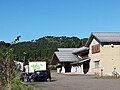 Kasugayama Castel ruins and Jōetsu-shi Maizō Bunkazai center
 -
 View of central Naoetsu area
 -
 View of Central Takada area


Climate
Jōetsu has a humid subtropical climate (Köppen climate classification Cfa). The average annual temperature is 13.4 °C. The average annual rainfall is 2599 mm with January as the wettest month. The temperatures are highest on average in August, at around 26.0 °C, and lowest in January, at around 2.2 °C.[2]
Owing to its coastal location facing onshore winds off the Sea of Japan, Jōetsu is the wettest low-lying part of the northern hemisphere temperate zone apart from the Owase region of the Kii Peninsula, receiving an average of around 2.8 metres (110.2 in) of precipitation per year. As a comparison, Forks on the windward side of Washington's Olympic Peninsula receives 110 inches (2.79 m) and Rize on the Black Sea coast of Turkey 2,530 millimetres (100 in). The cold winds from the combined power of the Siberian High and Aleutian Low give Jōetsu an average of 6.3 metres (250 in) of snowfall that however tends to melt significantly even during the winter. On February 26, 1945, Jōetsu received as much as 3.77 metres (148 in) of snow in one day. The heaviest annual snowfall, since the beginning of regular snowfall measurements in 1953, was 14.94 metres (590 in) in the 1985/1986 season and the heaviest monthly total precipitation 942 millimetres (37 in) in January 1945, whilst the driest month was August 1985 with 16 millimetres (0.63 in).
| Climate data for Takada, Jōetsu (1991−2020 normals, extremes 1922−present) | |||||||||||||
|---|---|---|---|---|---|---|---|---|---|---|---|---|---|
| Month | Jan | Feb | Mar | Apr | May | Jun | Jul | Aug | Sep | Oct | Nov | Dec | Year |
| Record high °C (°F) | 19.4 (66.9) |
21.9 (71.4) |
25.8 (78.4) |
32.3 (90.1) |
33.1 (91.6) |
36.4 (97.5) |
38.9 (102.0) |
40.3 (104.5) |
37.8 (100.0) |
34.1 (93.4) |
28.1 (82.6) |
23.7 (74.7) |
40.3 (104.5) |
| Mean daily maximum °C (°F) | 6.0 (42.8) |
6.7 (44.1) |
10.9 (51.6) |
17.6 (63.7) |
22.7 (72.9) |
25.8 (78.4) |
29.6 (85.3) |
31.3 (88.3) |
27.1 (80.8) |
21.5 (70.7) |
15.5 (59.9) |
9.3 (48.7) |
18.7 (65.6) |
| Daily mean °C (°F) | 2.5 (36.5) |
2.7 (36.9) |
5.8 (42.4) |
11.7 (53.1) |
17.0 (62.6) |
20.9 (69.6) |
25.0 (77.0) |
26.4 (79.5) |
22.3 (72.1) |
16.4 (61.5) |
10.5 (50.9) |
5.3 (41.5) |
13.9 (57.0) |
| Mean daily minimum °C (°F) | −0.4 (31.3) |
−0.8 (30.6) |
1.4 (34.5) |
6.1 (43.0) |
11.6 (52.9) |
16.7 (62.1) |
21.5 (70.7) |
22.6 (72.7) |
18.4 (65.1) |
12.1 (53.8) |
6.1 (43.0) |
1.8 (35.2) |
9.8 (49.6) |
| Record low °C (°F) | −10.7 (12.7) |
−13.2 (8.2) |
−10.3 (13.5) |
−6.5 (20.3) |
−0.4 (31.3) |
6.4 (43.5) |
11.6 (52.9) |
13.0 (55.4) |
8.3 (46.9) |
1.2 (34.2) |
−2.5 (27.5) |
−7.8 (18.0) |
−13.2 (8.2) |
| Average precipitation mm (inches) | 429.6 (16.91) |
263.3 (10.37) |
194.7 (7.67) |
105.3 (4.15) |
87.0 (3.43) |
136.5 (5.37) |
206.8 (8.14) |
184.5 (7.26) |
205.8 (8.10) |
213.9 (8.42) |
334.2 (13.16) |
475.5 (18.72) |
2,837.1 (111.70) |
| Average snowfall cm (inches) | 171 (67) |
139 (55) |
47 (19) |
2 (0.8) |
0 (0) |
0 (0) |
0 (0) |
0 (0) |
0 (0) |
0 (0) |
trace | 67 (26) |
413 (163) |
| Average precipitation days (≥ 1.0 mm) | 24.8 | 20.4 | 19.0 | 12.3 | 10.0 | 11.3 | 13.2 | 11.4 | 13.9 | 14.6 | 18.6 | 23.2 | 192.7 |
| Average snowy days (≥ 1 cm) | 19.7 | 17.8 | 8.5 | 0.4 | 0 | 0 | 0 | 0 | 0 | 0 | 0.1 | 9.8 | 56.3 |
| Average relative humidity (%) | 79 | 76 | 72 | 67 | 71 | 78 | 81 | 78 | 79 | 78 | 78 | 78 | 76 |
| Mean monthly sunshine hours | 62.4 | 83.2 | 128.7 | 177.6 | 201.8 | 153.6 | 148.4 | 189.6 | 136.7 | 131.8 | 104.1 | 73.0 | 1,591.8 |
| Source: Japan Meteorological Agency[3][4] | |||||||||||||
| Climate data for Ōgata, Jōetsu (1991−2020 normals, extremes 1978−present) | |||||||||||||
|---|---|---|---|---|---|---|---|---|---|---|---|---|---|
| Month | Jan | Feb | Mar | Apr | May | Jun | Jul | Aug | Sep | Oct | Nov | Dec | Year |
| Record high °C (°F) | 16.7 (62.1) |
22.7 (72.9) |
24.4 (75.9) |
30.4 (86.7) |
33.4 (92.1) |
34.4 (93.9) |
39.5 (103.1) |
40.0 (104.0) |
39.5 (103.1) |
35.7 (96.3) |
27.4 (81.3) |
23.5 (74.3) |
40.0 (104.0) |
| Mean daily maximum °C (°F) | 6.3 (43.3) |
6.7 (44.1) |
10.1 (50.2) |
15.6 (60.1) |
20.5 (68.9) |
23.9 (75.0) |
28.0 (82.4) |
30.0 (86.0) |
26.3 (79.3) |
20.8 (69.4) |
15.1 (59.2) |
9.5 (49.1) |
17.7 (63.9) |
| Daily mean °C (°F) | 2.9 (37.2) |
Zdroj:https://en.wikipedia.org?pojem=Jōetsu,_Niigata||||||||||||

