A | B | C | D | E | F | G | H | CH | I | J | K | L | M | N | O | P | Q | R | S | T | U | V | W | X | Y | Z | 0 | 1 | 2 | 3 | 4 | 5 | 6 | 7 | 8 | 9


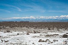
The Kura-Aras Lowland, Kura-Aras Depression or Kura-Aras Basin[1] (Azerbaijani: Kür-Araz ovalığı) is a vast depression in central-southern Azerbaijan defined by the valleys of the Kura River and Aras River. It is situated by the West shore of the Caspian Sea and is part of the Aral-Caspian Depression. It is delimited by the Greater Caucasus from the North, Lesser Caucasus from the West and the Talysh Mountains from the South.[2] The name is derived from the names of the two rivers in the area: the Kura and the Aras.[3]
See also
- Kura–Araxes culture or Kur–Araz culture, Bronze Age culture from the region
- Trans-Caucasus
References
- ^ The name of Aras may also be variously transliterates as Araz, Arax, or Araxes.
- ^ Profile of Azerbaijan Archived 2011-06-06 at the Wayback Machine, a 2003 World Bank document
- ^ "Azerbaijan - History, People, & Facts". britannica.com. Archived from the original on 10 March 2018. Retrieved 24 April 2018.
Further reading
- Akif A. Alizadeh, Ibrahim S. Guliyev, Fakhraddin A. Kadirov, Lev V. Eppelbaum (Jun 17, 2016). Geosciences of Azerbaijan. Springer. p. 17. ISBN 978-3-319-27395-2.
{{cite book}}: CS1 maint: multiple names: authors list (link)
41°10′00″N 45°50′00″E / 41.1667°N 45.8333°E
>Text je dostupný pod licencí Creative Commons Uveďte autora – Zachovejte licenci, případně za dalších podmínek. Podrobnosti naleznete na stránce Podmínky užití.
Text je dostupný za podmienok Creative
Commons Attribution/Share-Alike License 3.0 Unported; prípadne za ďalších
podmienok.
Podrobnejšie informácie nájdete na stránke Podmienky
použitia.

