A | B | C | D | E | F | G | H | CH | I | J | K | L | M | N | O | P | Q | R | S | T | U | V | W | X | Y | Z | 0 | 1 | 2 | 3 | 4 | 5 | 6 | 7 | 8 | 9
This article may be too long to read and navigate comfortably. (June 2023) |
Sabah | |
|---|---|
| State of Sabah Negeri Sabah (Malay) | |
| Nickname(s): | |
| Motto(s): | |
| Anthem: Sabah Tanah Airku[4] Sabah, My Homeland | |
 | |
OpenStreetMap  | |
| Coordinates: 5°15′N 117°0′E / 5.250°N 117.000°E | |
| Established under the Bruneian Empire | 15th century |
| Sultanate of Sulu | 1658 |
| British North Borneo | 1882 |
| Japanese occupation | 1942 |
| British crown colony | 15 July 1946 |
| Gained self-governance | 31 August 1963[5][6][7][8] |
| Federated into Malaysia[9] | 16 September 1963[10] |
| Capital (and largest city) | Kota Kinabalu |
| Divisions | |
| Government | |
| • Body | Sabah State Legislative Assembly |
| • Yang di-Pertua Negeri | Juhar Mahiruddin |
| • Chief Minister | Hajiji Noor (GRS–GAGASAN) |
| Area | |
| • Total | 73,904 km2 (28,534 sq mi) |
| Highest elevation | 4,095 m (13,435 ft) |
| Population (2020)[11] | |
| • Total | |
| • Density | 46/km2 (120/sq mi) |
| Demonym | Sabahan |
| Demographics (2022)[11] | |
| • Ethnic composition |
|
| Languages | |
| • Official | Malay |
| • Other spoken | |
| Time zone | UTC+8 (MST[12]) |
| Postal code | |
| Calling code | 087 (Inner District) 088 (Kota Kinabalu & Kudat) 089 (Lahad Datu, Sandakan & Tawau)[15] |
| ISO 3166 code | MY-12 |
| Vehicle registration | SA, SAA, SAB, SAC, SY (West Coast) SB (Beaufort) SD (Lahad Datu) SK (Kudat) SS, SSA, SM (Sandakan) ST, STA, SW (Tawau) SU (Keningau)[16] |
| HDI (2019) | high · 15th |
| GDP (nominal) | 2022 |
| • Total | (RM 122.138 billion)[18] (5th) |
| • Per capita | (RM 36,020)[18] (11th) |
| GDP (PPP) | 2022 |
| • Total | |
| • Per capita | |
| Driving side | Left |
| Electricity voltage | 230 V, 50 Hz |
| Currency | Malaysian ringgit (RM/MYR) |
| Website | Official website |


Sabah (Malay pronunciation: [saˈbah]), or given nickname Sabah Bumi Di Bawah Bayu (means Sabah Land Below The Wind) is a state of Malaysia located on the northern portion of Borneo, in the region of East Malaysia. Sabah has land borders with the Malaysian state of Sarawak to the southwest and Indonesia's North Kalimantan province to the south. The Federal Territory of Labuan is an island just off Sabah's west coast. Sabah shares maritime borders with Vietnam to the west and the Philippines to the north and east. Kota Kinabalu is the state capital and the economic centre of the state, and the seat of the Sabah State government. Other major towns in Sabah include Sandakan and Tawau. The 2020 census recorded a population of 3,418,785 in the state.[11] It has an equatorial climate with tropical rainforests, abundant with animal and plant species. The state has long mountain ranges on the west side which forms part of the Crocker Range National Park. Kinabatangan River, the second longest river in Malaysia runs through Sabah. The highest point of Sabah, Mount Kinabalu is also the highest point of Malaysia.
The earliest human settlement in Sabah can be traced back to 20,000–30,000 years ago along the Darvel Bay area at the Madai-Baturong caves. The state has had a trading relationship with China starting from the 14th century AD. Sabah came under the influence of the Bruneian Empire in the 14th and 15th centuries. The state was subsequently acquired by the British-based North Borneo Chartered Company in the 19th century. During World War II, Sabah was occupied by the Japanese for three years. It became a British Crown Colony in 1946. On 31 August 1963, Sabah was granted self-government by the British. Following this, Sabah became one of the founding members of the Federation of Malaysia (established on 16 September 1963) alongside the Crown Colony of Sarawak, the Colony of Singapore (expelled in 1965), and the Federation of Malaya (Peninsular Malaysia or West Malaysia). The federation was opposed by neighbouring Indonesia, which led to the Indonesia–Malaysia confrontation over three years along with the threats of annexation by the Philippines along with the Sultanate of Sulu, threats which continue to the present day.[19]
Sabah exhibits notable diversity in ethnicity, culture and language. The head of state is the Governor, also known as the Yang di-Pertua Negeri, while the head of government is the Chief Minister and his Cabinet. The government system is closely modelled on the Westminster parliamentary system and has one of the earliest state legislature systems in Malaysia. Sabah is divided into five administrative divisions and 27 districts. Malay is the official language of the state;[20][21] and Islam is the state religion, but other religions may be practised in peace and harmony in any part of the state.[22] Sabah is known for its traditional musical instrument, the sompoton. Sabah has abundant natural resources, and its economy is strongly export-oriented. Its primary exports include oil, gas, timber and palm oil. The other major industries are agriculture and ecotourism.
Etymology
The origin of the name Sabah is uncertain, and there are many theories that have arisen.[23] One theory is that during the time it was part of the Bruneian Sultanate, it was referred to as Saba because of the presence a variety of banana called pisang saba (also known as pisang menurun),[24][25] which is grown widely on the coast of the region and popular in Brunei.[26] The Bajau community referred to it as pisang jaba.[26] While the name Saba also refers to a variety of banana in both Tagalog and Visayan languages. The word in Visayan has the meaning of "noisy", which in turn is derived from Sanskrit Sabhā meaning 'congregation, crowd' related to 'noisy mob'.[23] Perhaps due to local dialect, the word Saba has been pronounced as Sabah by the local community.[24] While Brunei was a vassal state of Majapahit, the Old Javanese eulogy of Nagarakretagama described the area in what is now Sabah as Seludang.[5][24]
Meanwhile, although the Chinese since during the Han dynasty had long been associated with the island of Borneo,[27][28] they did not have any specific names for the area. Instead during the Song dynasty, they referred to the whole island as Po Ni (also pronounced Bo Ni), which is the same name they used to refer to the Sultanate of Brunei at the time.[23] Due to the location of Sabah in relation to Brunei, it has been suggested that Sabah was a Brunei Malay word meaning upstream or "in a northerly direction".[25][29][30] Another theory suggests that it came from the Malay word sabak which means a place where palm sugar is extracted.[31] Sabah (صباح) is also an Arabic word which means "morning".
The presence of multiple theories makes it difficult to pinpoint the true origin of the name.[32] It is nicknamed "Land Below the Wind" (Negeri Di Bawah Bayu) as the state lies below the typhoon belt of East Asia and never battered by any typhoons,[33][34] except for several tropical storms.[35]
History
Prehistory

The earliest known human settlement into the region existed 20,000–30,000 years ago, as evidenced by stone tools and food remains found by excavations along the Darvel Bay area at Madai-Baturong caves near the Tingkayu River.[36] The earliest inhabitants in the area were thought to be similar to Aboriginal Australians, but the reason for their disappearance is unknown.[37] In 2003, archaeologists discovered the Mansuli valley in the Lahad Datu District, which dates back the history of Sabah to 235,000 years.[38] The archaeological site at Skull Hill (Bukit Tengkorak) in Semporna District is famed for being the largest pottery making site during the Neolithic Southeast Asian period.[39][40]
Sultanates of Brunei and Sulu influences
During the 7th century AD, a settled community known as Vijayapura, a tributary to the Srivijaya empire, was thought to have existed in northwest Borneo.[41][42] The earliest independent kingdom in Borneo, supposed to have existed from the 9th century, was Po Ni, as recorded in the Chinese geographical treatise Taiping Huanyu Ji. It was believed that Po Ni existed at the mouth of Brunei River and was the predecessor to the Bruneian Empire.[42][43] As China had been under the conquest of Mongol Empire, all Chinese vassal state subsequently controlled by the Mongol emperors of China. Early in 1292, Kublai Khan is said to have sent an expedition to northern Borneo,[44] before departing for the invasion of Java in 1293.[45][46] As a result of this campaign, it is believed that many of his followers in addition to other Chinese traders eventually settled and established their own enclave at Kinabatangan River.[44]
In the 14th century, Brunei and Sulu was part of the Majapahit Empire but in 1369, Sulu and the other Philippine kingdoms successfully rebelled and Sulu even attacked Brunei which was still a Majapahit tributary,[47] the Sulus specifically invaded Northeast Borneo at Sabah[48] the Sulus were then repelled but Brunei became weakened.[49] In 1370, Brunei transferred its allegiance to Ming dynasty of China.[50][51] The Maharaja Karna of Borneo then paid a visit to Nanjing with his family until his death.[52] He was succeeded by his son Hsia-wang who agreed to send tribute to China once every three years.[50][51] After that, Chinese junks came to northern Borneo with cargoes of spices, bird nests, shark fins, camphor, rattan and pearls.[53] More Chinese traders eventually settled in Kinabatangan, as stated in both Brunei and Sulu records.[50][54] A younger sister of Ong Sum Ping (Huang Senping), the Governor of the Chinese settlement then married Sultan Ahmad of Brunei.[50][55] Perhaps due to this relationship, a burial place with 2,000 wooden coffins, some estimated to be 1,000 years old, were discovered in Agop Batu Tulug Caves and around the Kinabatangan Valley area.[56][57] It is believed that this type of funeral culture was brought by traders from Mainland China and Indochina to northern Borneo as similar wooden coffins were also discovered in these countries.[56] In addition with the discovery of Chinese ceramics from a shipwreck in Tanjung Simpang Mengayau which estimated to be from 960 to 1127 AD of Song dynasty and Vietnamese Đông Sơn drum in Bukit Timbang Dayang on Banggi Island that had existed between 2,000 and 2,500 years ago.[37][58][59]
During the reign of the fifth sultan of Bolkiah between 1485 and 1524, the Sultanate's thalassocracy extended over northern Borneo and the Sulu Archipelago, as far as Kota Seludong (present-day Manila) with its influence extending as far of Banjarmasin,[60] taking advantage of maritime trade after the fall of Malacca to the Portuguese.[61][62] Many Brunei Malays migrated to Sabah during this period, beginning after the Brunei conquest of the territory in the 15th century.[63] But plagued by internal strife, civil war, piracy and the arrival of western powers, the Bruneian Empire began to shrink. The first Europeans to visit Brunei were the Portuguese, who described the capital of Brunei at the time as surrounded by a stone wall.[61] The Spanish followed, arriving soon after Ferdinand Magellan's death in 1521, when the remaining members of his expedition sailed to the islands of Balambangan and Banggi in the northern tip Borneo; later, in the Castilian War of 1578, the Spanish who had sailed from New Spain (Centered in Mexico) and had taken Manila from Brunei, unsuccessfully declared war on Brunei by briefly occupying the capital before abandoning it.[5][59][64] The Sulu region gained its own independence in 1578, forming their own sultanate known as the Sultanate of Sulu.[65]
When the civil war broke out in Brunei between Sultans Abdul Hakkul Mubin and Muhyiddin, the Sulu Sultan asserted their claim to Brunei's territories in northern Borneo.[64][66] The Sulus claimed that Sultan Muhyiddin had promised to cede the northern and eastern portion of Borneo to them in compensation for their help in settling the civil war.[64][67] The territory seems never to have been ceded formally, but the Sulus continued to claim the territory, with Brunei weakened and unable to resist.[68] After the war with the Spanish, the area in northern Borneo began to fall under the influence of the Sulu Sultanate.[64][67] The seafaring Bajau-Suluk and Illanun people then arrived from the Sulu Archipelago and started settling on the coasts of north and eastern Borneo,[69] many of them were fleeing from the oppression of Spanish colonialism.[70] While the thalassocratic Brunei and Sulu sultanates controlled the western and eastern coasts of Sabah respectively, the interior region remained largely independent from either kingdoms.[71] The Sultanate of Bulungan's influence was limited to the Tawau area,[72] who came under the influence of the Sulu Sultanate before gaining its own rule after the 1878 treaty between the British and Spanish governments.[73]
British North Borneo
_1877.jpg)
_1878.jpg)
In 1761, Alexander Dalrymple, an officer of the British East India Company, concluded an agreement with the Sultan of Sulu to allow him to set up a trading post for the first time in northern Borneo, although this was to prove a failure.[74] Following the British occupation of Manila in 1763, the British freed the Sultan Alimuddin from Spanish colonisers and allowed him to return to his throne;[75] this was welcomed by the Sulu people and by 1765, Dalrymple managed to obtain the island, having concluded a Treaty of Alliance and Commerce with the Sultan of Sulu by the willing of Sultan Alimuddin as a sign of gratitude for the British aid.[67][75] A small British factory was then established in 1773 on Balambangan Island, a tiny island situated off the north coast of Borneo.[67] The British saw the island as a suitable location to control the trade route in the East, capable of diverting trade from the Spanish port of Manila and the Dutch port of Batavia especially with its strategic location between the South China Sea and Sulu Sea.[67] But the British abandoned the island two years later when the Sulu pirates began attacking.[54] This forced the British to seek refuge in Brunei in 1774, and to abandon temporarily their attempts to find alternative sites for the factory.[67] Although an attempt was made in 1803 to turn Balambangan into a military station,[54] the British did not re-establish any further trading posts in the region until Stamford Raffles founded Singapore in 1819.[67]
In 1846, the island of Labuan on the west coast of Sabah was ceded to Britain by the Sultan of Brunei through the Treaty of Labuan, and in 1848 it became a British Crown Colony.[54] Seeing the presence of British in Labuan, the American consul in Brunei, Claude Lee Moses, obtained a ten-year lease in 1865 for a piece of land in northern Borneo. Moses then passed the land to the American Trading Company of Borneo, a company owned by Joseph William Torrey and Thomas Bradley Harris as well Chinese investors.[54][76] The company choose Kimanis (which they renamed "Ellena") and start to build a base there. Requests for financial backing from the US government proved futile and the settlement was later abandoned. Before he left, Torrey managed to sell all his rights to the Austrian Consul in Hong Kong, von Overbeck. Overbeck then went to Brunei, where he met the Temenggong to renew the concession.[76] Brunei agreed to cede all territory in northern Borneo under its control, with the Sultan receiving an annual payment of $12,000, while the Temenggong received a sum of $3,000.[67]
In 1872, the Sultanate of Sulu granted use of an area of land in the Sandakan Bay to William Frederick Schuck, a former agent of the German consular service who had lived on the Sulu island of Jolo since 1864. The arrival of German warship Nymph at the Sulu Sea in 1872 to investigate the Sulu-Spanish conflict made the Sultanate believe Schuck was connected with the German government.[77] The Sultanate authorised Schuck to establish a trading port to monopolise the rattan trade in the northeast coast, where Schuck could operate freely, without the Spanish blockade.[78] He continued this operation until this land also was ceded to Overbeck, with the Sultan receiving an annual payment of $5,000, by a treaty signed in 1878.[67]
After a series of transfers, Overbeck tried to sell the territory to Germany, Austria-Hungary and Italy but all rejected his offer.[76] Overbeck then co-operated with the British Dent brothers (Alfred Dent and Edward Dent) for financial backing to develop the land, with the Dent company persuading him that any investors would need guarantees of British military and diplomatic support.[76] Overbeck agreed to this co-operation, especially with regard to the counterclaims of the Sultan of Sulu, part of whose territory in the Sulu Archipelago had been occupied by Spain.[76] Overbeck, however, withdrew in 1879 and his treaty rights were transferred to Alfred Dent, who in 1881 formed the North Borneo Provisional Association Ltd to administer the territory.[79][80][81] In the following year, Kudat was made its capital but due to frequent pirate attacks, the capital was moved to Sandakan in 1884.[41] To prevent further disputes over intervention, the governments of the United Kingdom, Spain and Germany signed the Madrid Protocol of 1885, recognising the sovereignty of the King of Spain over the Sulu Archipelago in return for the relinquishment of all Spanish claims over northern Borneo.[82] The arrival of the company brought prosperity to the residents of northern Borneo, with the company allowing indigenous communities to continue their traditional lifestyles, but imposing laws against headhunting, ethnic feuds, slave trade, and piracy.[83][84] North Borneo then became a protectorate of the United Kingdom in 1888 despite facing local resistance from 1894 to 1900 by Mat Salleh and Antanum in 1915.[54][84]
Second World War
.JPG)
The Japanese forces landed in Labuan on 3 January 1942,[85] during the Second World War, and later invaded the rest of northern Borneo.[54] From 1942 to 1945, Japanese forces occupied North Borneo, along with most of the rest of the island, as part of the Empire of Japan. The British saw Japanese advances in the area as motivated by political and territorial ambitions rather than economic factors.[86] The residing British and the locals were compelled to obey and gave in to the brutality of the Japanese.[87] The occupation drove many people from coastal towns to the interior, fleeing the Japanese and seeking food.[88] The Malays generally appeared to be favoured by the Japanese, although some of them faced repression, whilst other races such as the Chinese and indigenous peoples were severely repressed.[89] The Chinese were already resisting the Japanese occupation, especially with the Sino-Japanese War in Mainland China.[90] Local Chinese formed a resistance, known as the Kinabalu Guerillas, led by Albert Kwok, with broad support from various ethnic groups in northern Borneo such as Dusun, Murut, Suluk and Illanun peoples. The movement was also supported by Mustapha Harun.[91] Kwok along with many other sympathisers were, however, executed after the Japanese foiled their movement in the Jesselton Revolt.[88][92]
As part of the Borneo Campaign to retake the territory, Allied forces bombed most of the major towns under Japanese control, including Sandakan, which was razed to the ground. The Japanese ran a brutal prisoner of war camp known as Sandakan camp for those siding with the British.[93] The majority of the POWs were British and Australian soldiers captured after the fall of Malaya and Singapore.[94][95] The prisoners suffered notoriously inhuman conditions, and amidst continuous Allied bombardments, the Japanese forced them to march into Ranau, which is about 260 kilometres away, in an event known as the Sandakan Death March.[96] The number of prisoners were reduced to 2,345, with many of them killed en route by either friendly fire or by the Japanese. Only six of the several hundred Australian prisoners lived to see the war's end.[97] In addition, of the total of 17,488 Javanese labourers brought in by the Japanese during the occupation, only 1,500 survived mainly due to starvation, harsh working conditions and maltreatment.[88] In March 1945, Australian forces launched Operation Agas in order to gather intelligence in the region and launch guerrilla warfare against the Japanese.[98] The war ended on 10 September 1945 after the Australian Imperial Forces (AIF) succeeded in the battle of North Borneo.[54][99]
British crown colony
After the Japanese surrender, North Borneo was administered by the British Military Administration and on 15 July 1946 became a British Crown Colony.[54][100] The Crown Colony of Labuan was integrated into this new colony. During the ceremony, both the Union Jack and Flag of the Republic of China were raised from the bullet-ridden Jesselton Survey Hall building.[100] The Chinese were represented by Philip Lee, part of the resistance movement against the Japanese, who eventually supported the transfer of power to the Crown colony.[100] He said: "Let their blood be the pledge of what we wish to be—His Majesty's most devoted subjects."[100]
Due to massive destruction in the town of Sandakan since the war, Jesselton was chosen to replace the capital with the Crown continued to rule North Borneo until 1963. The Crown colony government established many departments to oversee the welfare of its residents and to revive the economy of North Borneo after the war.[101] Upon Philippine independence in 1946, seven of the British-controlled Turtle Islands (including Cagayan de Tawi-Tawi and Mangsee Islands) off the north coast of Borneo were ceded to the Philippines as had been negotiated by the American and British colonial governments.[102][103]
Malaysia
.jpg)
On 31 August 1963, North Borneo attained self-government.[6][7][8] The Cobbold Commission had been set up prior, in 1962, to determine whether the people of Sabah and Sarawak favoured the proposed union of a new federation called Malaysia, and found that the union was generally favoured by the people.[104] Most ethnic community leaders of Sabah, namely, Mustapha Harun representing the native Muslims, Donald Stephens representing the non-Muslim natives, and Khoo Siak Chew representing the Chinese, would eventually support the union.[91][105][106] After discussion culminating in the Malaysia Agreement and 20-point agreement, on 16 September 1963 North Borneo (as Sabah) was united with Malaya, Sarawak and Singapore, to form the independent Malaysia.[107][108]
From before the formation of Malaysia until 1966, Indonesia adopted a hostile policy towards the British-backed Malaya, leading after union to the Indonesia–Malaysia confrontation.[109] This undeclared war stemmed from what Indonesian President Sukarno perceived as an expansion of British influence in the region and his intention to wrest control over the whole of Borneo under the Greater Indonesian concept.[110] Meanwhile, the Philippines, beginning with president Diosdado Macapagal on 22 June 1962, claims Sabah from cession by heirs of the Sultanate of Sulu.[111][112] Macapagal, considering Sabah to be property of the Sultanate of Sulu, saw the attempt to integrate Sabah, Sarawak and Brunei into the Federation of Malaysia as "trying to impose authority of Malaya into these states".[111]
Following the successful formation of Malaysia, Donald Stephens became the first chief minister of Sabah. The first Governor Yang di-Pertua Negara (which later changed to Yang di-Pertua Negeri in 1976) was Mustapha Harun.[113] The leaders of Sabah demanded that their freedom of religion be respected, that all lands in the territory be under the power of state government, and that native customs and traditions be respected and upheld by the federal government; declaring that in return Sabahans would pledge their loyalty to the Malaysian federal government. An oath stone was officially officiated by the first Chief Minister Donald Stephens on 31 August 1964 in Keningau as a remembrance to the agreement and promise for reference in the future.[114] Sabah held its first state election in 1967.[115] In the same year, the state capital name of "Jesselton" was renamed to "Kota Kinabalu".[116]
An airplane crash on 6 June 1976 killed Stephens along with four other state cabinet ministers.[117] On 14 June 1976, the state government of Sabah led by the new chief minister Harris Salleh signed an agreement with Petronas, the federal government-owned oil and gas company, granting it the right to extract and earn revenue from petroleum found in the territorial waters of Sabah in exchange for 5% in annual revenue as royalties based on the 1974 Petroleum Development Act.[118] The state government of Sabah ceded Labuan to the Malaysian federal government, and Labuan became a federal territory on 16 April 1984.[119] In 2000, the state capital Kota Kinabalu was granted city status, making it the 6th city in Malaysia and the first city in the state.[120] Prior to a territorial dispute between Indonesia and Malaysia since 1969 over two islands of Ligitan and Sipadan in the Celebes Sea, the International Court of Justice (ICJ) made a final decision to award both islands to Malaysia in 2002 based on their "effective occupation".[121][122]
In February 2013, Sabah's Lahad Datu District was penetrated by followers of Jamalul Kiram III, the self-proclaimed Sultan of the Sulu Sultanate. In response, Malaysian military forces were deployed to the region, which resulted in 68 deaths (58 Sultanate militants, nine Malaysian security personnel, and six civilians). Following the elimination of insurgents, an Eastern Sabah Security Command was established.[123][124]
Politics
Government

Sabah (together with its neighbour Sarawak) has a greater level of autonomy in administration, immigration, and judiciary which differentiates it from the Malaysian Peninsula states. The Yang di-Pertua Negeri is the head of state although its functions are largely ceremonial.[125] Next in the hierarchy are the state legislative assembly and the state cabinet.[5][125] The chief minister is the head of government as well the leader of the state cabinet.[125] The legislature is based on the Westminster system and therefore the chief minister is appointed based on his or her ability to command the majority of the state assembly.[5][126] While local authorities being fully appointed by the state government owing to the suspension of local elections by the federal government. Legislation regarding state elections is within the powers of the federal government and not the state.[5] The assembly meets at the state capital, Kota Kinabalu. Members of the state assembly are elected from 73 constituencies which are delineated by the Election Commission of Malaysia and do not necessarily have the same voter population sizes.[127] A general election for representatives in the state assembly must be held every five years, when the seats are subject of universal suffrage for all citizens above 21 years of age. Sabah is also represented in the federal parliament by 25 members elected from the same number of constituencies.
Prior to the formation of Malaysia in 1963, the then North Borneo interim government submitted a 20-point agreement to the Malayan government as conditions before North Borneo would join the federation. Subsequently, North Borneo legislative assembly agreed on the formation of Malaysia on the conditions that North Borneo's rights would be safeguarded. North Borneo then entered Malaysia as an autonomous state with autonomous laws in immigration control and Native Customary Rights (NCR), and the territory name was changed to "Sabah". However, under the administration of the United Sabah National Organisation (USNO) led by Mustapha Harun, this autonomy has been gradually eroded with federal government influence and hegemony with a popular belief amongst Sabahans that both USNO and UMNO have been working together in permitting illegal immigrants from the southern Philippines and Indonesia to stay in the state and become citizens to vote for Muslim parties.[128] This was continued under the Sabah People's United Front (BERJAYA) administration led by Harris Salleh with a total of 73,000 Filipino refugees from the southern Philippines were registered.[129] In addition, the cession of Labuan island to federal government by the Sabah state government under BERJAYA rule and unequal sharing and exploitation of Sabah's resources of petroleum have become grievances often raised by Sabahans, which has resulted in strong anti-federal sentiments and even occasional call for secession from the federation amongst the people of Sabah.[88] Those who spread secession agenda often landed in law enforcement hand due to the controversial ISA act, such as 1991 Sabah political arrests.[130]

Until the 2008 Malaysian general election, Sabah along with the states of Kelantan and Terengganu, were the only three states in Malaysia that had ever been ruled by opposition parties not part of the ruling BN coalition. Under Joseph Pairin Kitingan, PBS formed the state government after winning the 1985 state election and ruled Sabah until 1994. In the 1994 state election, despite PBS winning the elections, subsequent cross-overs of PBS assembly members to the BN component party resulted in BN having the majority of seats and hence took over the helm of the state government.[131] A unique feature of Sabah politics was a policy initiated by Prime Minister Mahathir Mohamad in 1994 whereby the chief minister's post is rotated among the coalition parties every two years regardless of the party in power at the time, thus theoretically giving an equal amount of time for each major ethnic group to rule the state. However, in practice, this system was problematic as it is too short for any leader to carry out long-term plans.[132] This practice was then since stopped.[133] Political intervention by the federal authorities, for example, an introduction and later abolition of the chief minister's post and earlier PBS-BERJAYA conflict in 1985, along with co-opting rival factions in East Malaysia, are examples of political tactics used by the then UMNO-led federal government to control and manage the autonomous power of the Borneo states.[134] The federal government however tend to view that these actions are justifiable as the display of parochialism amongst East Malaysians is not in harmony with nation building. This complicated Federal-State relationship has become a source of major contention in Sabah politics.[88]


In the 2018 general election, Shafie Apdal's Sabah Heritage Party (WARISAN) secured an electoral pact with the Democratic Action Party (DAP) and People's Justice Party (PKR) of the Pakatan Harapan (PH) coalition. On 9 May 2018, this coalition and the Barisan Nasional ended in a tie.[135] However, as six BN elected representatives crossed over to WARISAN,[136][137] and after a short-lived constitutional crisis,[138][139] a coalition of WARISAN, DAP and PKR formed a majority government on 12 May 2018 and became effective since that day.[140][141][142][143] In conjunction with the celebration of Malaysia Day in 2018 under the new government, Prime Minister Mahathir has promised to restore Sabah (together with Sarawak) status as an equal partner to Malaya who together forming the Malaysian federation in accordance to the Malaysia Agreement.[144][145] However, through the process of the proposed amendment to the Constitution of Malaysia in 2019, the bill for the amendment failed to pass following the failure to reach two-thirds majority support (148 votes) in the Parliament with only 138 agreed with the move while 59 abstained from the voting.[146][147]
Administrative division
Sabah consists of five administrative divisions, which are in turn divided into 27 districts. For each district, the state government appoints a village headman (known as ketua kampung) for each village. The administrative divisions were inherited from the provinces of the British administration.[148] During the British rule, a Resident was appointed to govern each division and provided with a palace (Istana).[149] The post of the Resident was abolished and replaced with district officers for each of the district when North Borneo became part of Malaysia. As in the rest of Malaysia, local government comes under the purview of state government.[5] However, ever since the suspension of local government elections in the midst of the Malayan Emergency, which was much less intense in Sabah than it was in the rest of the country, there have been no local elections. Local authorities have their officials appointed by the executive council of the state government.[150][151]
| Division | Districts | Subdistricts | Area (km2) | Population (2010)[152] | |
|---|---|---|---|---|---|
| 1 | West Coast Division | Kota Kinabalu | 7,588 | 1,067,589 | |
| Penampang | |||||
| Putatan | |||||
| Papar | |||||
| Tuaran | Tamparuli | ||||
| Kiulu | |||||
| Kota Belud | |||||
| Ranau | |||||
| 2 | Interior Division | Beaufort | 18,298 | 424,534 | |
| Kuala Penyu | Menumbok | ||||
| Sipitang | Long Pasia | ||||
| Tambunan | |||||
| Keningau | Sook | ||||
| Tenom | Kemabong | ||||
| Nabawan | Pagalungan | ||||
| Membakut | |||||
| 3 | Kudat Division | Kudat | Banggi | 4,623 | 192,457 |
| Matunggong | |||||
| Pitas | |||||
| Kota Marudu | |||||
| 4 | Sandakan Division | Sandakan | 28,205 | 702,207 | |
| Beluran | Paitan | ||||
| Telupid | |||||
| Tongod | |||||
| Kinabatangan | |||||
| 5 | Tawau Division | Tawau | 14,905 | 819,955 | |
| Kalabakan | |||||
| Semporna | |||||
| Kunak | |||||
| Lahad Datu | Tungku | ||||
Security
.jpg)
The Ninth Schedule of the Constitution of Malaysia states that the Malaysian federal government is solely responsible for foreign policy and military forces in the country.[153] Before the formation of Malaysia, North Borneo security was the responsibility of Great Britain, Australia and New Zealand.[154] In the wake of threats of "annexation" from the Philippines after President Ferdinand Marcos signed a bill by including Sabah as part the Republic of the Philippines on its maritime baselines in the Act of Congress on 18 September 1968,[155] the British responds in the next day by sending their Hawker Hunter fighter-bomber jets to Kota Kinabalu with the jets stopped over at the Clark Air Base not far from the Philippines capital of Manila.[156] British Army senior officer Michael Carver then reminded the Philippines that Britain would honour its obligations under the Anglo-Malayan Defence Agreement (AMDA) if fighting broke out.[156] In addition, a large flotilla of British warships would sail to Philippines waters near Sabah en route from Singapore along with the participation of ANZUS forces.[156] The AMDA treaty have since been replaced by the Five Power Defence Arrangements (FPDA) although the present treaty does not include East Malaysian states as its main priority, British security protection intervention can still be included over the two states.[155][157] Citing in 1971 when British Prime Minister Edward Heath been asked in Parliament of London on what threats the British intended to counter under the FPDA, the Prime Minister replied: to "forces outside in southern Thailand and north of the Malaysian border".[note 1]
The area in eastern Sabah facing the southern Philippines and northern Indonesia have since been put under the Eastern Sabah Security Command (ESSCOM) and Eastern Sabah Security Zone (ESSZONE) following the infiltration of militants, illegal immigrants and smuggling of goods and subsidies items into and from the southern Philippines and Indonesia.[158][159]
Territorial disputes

Sabah has seen several territorial disputes with Malaysia's neighbours Indonesia and the Philippines. In 2002, both Malaysia and Indonesia submitted to arbitration by the ICJ on a territorial dispute over the Ligitan and Sipadan islands which were later won by Malaysia.[121][122] There are also several other disputes yet to be settled with Indonesia over the overlapping claims on the Ambalat continental shelf in the Celebes Sea and land border dispute between Sabah and North Kalimantan.[161] Malaysia's claim over a portion of the Spratly Islands is also based on sharing a continental shelf with Sabah.[162]
The Philippines has a territorial claim over much of the eastern part of Sabah.[50][66][163] It claims that the territory is connected with the Sultanate of Sulu and was only leased to the North Borneo Chartered Company in 1878 with the Sultanate's sovereignty never being relinquished.[112] Malaysia however, considers this dispute as a "non-issue", as it interprets the 1878 agreement as that of cession and that it deems that the residents of Sabah had exercised their right to self-determination when they joined to form the Malaysian federation in 1963.[164] With an objective to reinforce the Philippine claim over the eastern region of Sabah, a group of 200 armed Filipinos identifying themselves as the Royal Security Forces of the Sultanate of Sulu and North Borneo landed in the district of Lahad Datu and took control of the Tanduo village in 2013. [165]This Lahad Datu incident resulted in the deaths of 52 members of the Sulu group and eight Malaysian police officers.[166]
Before this incident, Malaysia continued to dutifully pay an annual cession payment amounting to roughly $1,000 to the indirect heirs of the Sultan honoring an 1878 agreement, where North Borneo – today’s Sabah – was conceded by the late Sultan of Sulu to a British company.[167] However, the Malaysian government halted the payments after this tragedy. As a result, the self-proclaimed Sulu heirs pursued this case for legal arbitration vis-a-vis the original commercial deal.
Since then, Sulu claimants have been accused of “forum shopping”.[168] In 2017, the heirs showed their intention to start arbitration in Spain and asked for $32.2 billion in compensation. In 2019, Malaysia responded for the first time. The attorney general at the time offered to start making yearly payments again and to pay 48,000 Malaysian ringgit (about $10,400) for past dues and interest, but only if the heirs gave up their claim. [169][170]The heirs did not accept this offer and the case, led by Spanish arbiter Gonzalo Stampa, continued without Malaysia being involved.
In February 2022, Gonzalo Stampa awarded US$14.9 billion to the Sultan of Sulu’s heirs, who have since sought to enforce the award against Malaysian state-owned assets around the world. [171] It is noteworthy that on 27 June 2023, the Hague Court of Appeal dismissed the Sulus’ bid and ruled in favor of the Malaysian government, which hailed the decision as a “landmark victory”. [172] In a crucial current development, Stampa has been convicted of contempt of court for “knowingly disobeying rulings and orders from the Madrid High Court of Justice”, and sentenced to six months in prison. [173] The proceedings of this case are still ongoing.
The Philippine claim can be originated based on three historical events; such as the Brunei Civil War from 1660 until 1673, treaty between Dutch East Indies and the Bulungan Sultanate in 1850 and treaty between Sultan Jamal ul-Azam with Overbeck in 1878.[66][174]
Further attempts by several Filipino politicians such as Ferdinand Marcos to "destabilise" Sabah proved to be futile and led to the Jabidah massacre in Corregidor Island, Philippines.[156][175] As a consequence, this led the Malaysian government to once supporting the insurgency in southern Philippines.[176][177] Although the Philippine claim to Sabah has not been actively pursued for some years, some Filipino politicians have promised to bring it up again,[178] while the Malaysian government have asked the Philippines not to threaten ties over such issue.[179] To further discourage pursuit of the claim the Malaysian government passed a barter trade ban, at the behest of the Royal Malaysia Police and the Malaysian Deputy Prime Minister, between Malaysia and the Philippines as it was seen to only benefit one side while threatening the security of the state.[180][181] The ban was positively received by many Sabahans, although there was opposition from other political parties as well as from the residents of neighbouring Philippine islands due to a sharp rise in living costs after the ban took effect.[182] Barter trade activity was resumed on 1 February 2017 upon the agreement by both Malaysian and the Philippine authorities to fortify their respective borders with increased surveillance and security enforcement.[183][184] Despite the return of barter trade activity, the state of Sabah maintained that they will remain vigilant in trading with the Philippines.[185] In 2016, Philippine President Rodrigo Duterte and Malaysian Prime Minister Najib Razak have agreed to set aside the two countries' dispute over Sabah for the meantime.[186]
Geography

The total land area of Sabah is nearly 73,904 square kilometres (28,534 sq mi)[188] surrounded by the South China Sea in the west, Sulu Sea in the northeast and Celebes Sea in the southeast.[2] Sabah has a total of 1,743 kilometres (1,083 mi) coastline, of which 295.5 kilometres (183.6 mi) have been eroding.[189] Because of Sabah coastline facing three seas, the state receive an extensive marine resources.[190] In 1961, Sabah including neighbouring Sarawak, which had been included in the International Maritime Organization (IMO) through the participation of the United Kingdom, became joint associate members of the IMO.[191] Its exclusive economic zone (EEZ) is much larger towards the South China Sea and Celebes Sea than to the Sulu Sea.[192] The state coastline is covered with mangrove and nipah forests. The mangroves cover about 331,325 hectares of the state land and constitute 57% of the total mangroves in the country.[192] Both coastal areas in the west coast and east coast are entirely dominating by sand beaches, while in sheltered areas the sand was mixed with mud.[193] The northern area of Tanjung Simpang Mengayau has a type of pocket beach.[194] The areas in the west coast has a large freshwater wetlands, with the Klias Peninsula hosts a large area of tidal wetlands[195] and a wetland centre known as the Kota Kinabalu Wetland Centre was designated as a Ramsar site in 2016.[196] The western part of Sabah is generally mountainous, containing three highest peak. The main mountain ranges is the Crocker Range with several mountains varying height from about 1,000 metres to 4,000 metres. Adjacent to the Crocker Range is the Trus Madi Range with Mount Trus Madi, with a height of 2,642 metres.[197] The highest peak is the Mount Kinabalu, with a height around 4,095 metres.[198] It is one of the highest peak between the Himalayas and New Guinea.[199] While located not far from Mount Kinabalu is Mount Tambuyukon, with a height of 2,579 metres.[200]
These mountains and hills are traversed by an extensive network of river valleys and are in most cases covered with dense rainforest. There are lower ranges of hills extending towards the western coasts, southern plains, and the interior or central part of Sabah. The central and eastern portions of Sabah are generally lower mountain ranges and plains with occasional hills. In the east coast located the Kinabatangan River, which is the second-longest river in Malaysia after Rajang River in Sarawak with a length of 560 kilometres.[201] The river begins from the western ranges and snakes its way through the central region towards the east coast out into the Sulu Sea. Other major rivers including the Kalabakan River, Kolopis River, Liwagu River, Padas River, Paitan River, Segama River and Sugut River, in addition to Babagon River, Bengkoka River, Kadamaian River, Kalumpang River, Kiulu River, Mawao River, Membakut River, Mesapol River, Nabawan River, Papar River, Pensiangan River, Tamparuli River and Wario River.[202]
The land of Sabah is located in a tropical geography with equatorial climate. It experiences two monsoon seasons of northeast and southwest. The northeast monsoon occurs from November to March with heavy rains, while the southwest monsoon prevails from May to September with less rainfall.[202] It also received two inter-monsoon season from April to May and September to October. The average daily temperature varies from 27 °C (81 °F) to 34 °C (93 °F), with a considerable amount of rain from 1,800 millimetres to 4,000 millimetres.[202] The coastal areas occasionally experience severe storms as the state is situated south of the typhoon belt.[202] Due to its location is very close to the typhoon belt, Sabah experience the worst Tropical Storm Greg on 25 December 1996.[203] The storm left more than 100 people dead, with another 200–300 missing, 3,000–4,000 people left homeless.[204][205] As Sabah also lies within the Sunda Plate with a compression from the Australian and Philippine Plate, it is prone to earthquake with the state itself have experienced three major earthquakes since 1923, with the 2015 earthquake being the latest major earthquake.[206] The Crocker Ranges together with Mount Kinabalu was formed since during the middle Miocene period after being uplifted by the Sabah Orogeny through compression.[207] There was some snow here in 1975 and 1993.[208]
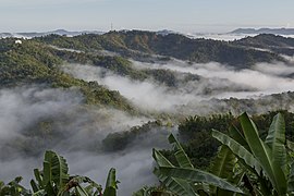
- Landscapes of Sabah
-
 Subsidiary peak of Mount Kinabalu
 -

-
 Lahad Datu District sea panoramic view
 -
 Padas River Valley
 -
 The northern tip of Borneo at Tanjung Simpang Mengayau facing both the South China Sea and Sulu Sea.
 -


Biodiversity
.jpg)
The Semporna Peninsula on the north-eastern coast of Sabah is identified as a hotspot of high marine biodiversity importance in the Coral Triangle.[209]
The jungles of Sabah host a diverse array of plant and animal species. Most of Sabah's biodiversity is located in the forest reserve areas, which formed half of its total landmass of 7.34 million hectares.[210] Its forest reserve are part of the 20 million hectares equatorial rainforests demarcated under the "Heart of Borneo" initiative.[210] The forests surrounding the river valley of Kinabatangan River is the largest forest-covered floodplain in Malaysia.[211] The Crocker Range National Park is the largest national park in the state, covering an area of 139,919 hectares. Most of the park area are covered in dense forest and important as a water catchment area with its headwater connecting to five major rivers in the west coast area.[212] Kinabalu National Park was inscribed as a World Heritage Site by UNESCO in 2000 for its richness in plant diversity combined with its unique geological, topographical, and climatic conditions.[213] The park hosts more than 4,500 species of flora and fauna, including 326 bird and around 100 mammal species along with over 110 land snail species.[214][215]

Tiga Island is formed through the eruption of mud volcano in 1897. The island is now part of the Tiga Island National Park together with Kalampunian Besar and Kalampunian Damit islands as a tourist attractions,[216] with a mud bath tourism.[217] The Tunku Abdul Rahman National Park is a group of five islands of Gaya, Manukan, Mamutik, Sapi and Sulug. These islands are believed to once connected to the Crocker Range but separated when sea levels rose since the last ice age.[218] The Tun Mustapha Marine Park is the largest marine park located in the north of Sabah. It covers the three major islands of Banggi, Balambangan and Malawali.[219] Another marine park is the Tun Sakaran Marine Park located in the south-east of Sabah. The park comprising the islands of Bodgaya, Boheydulang, Sabangkat and Salakan along with sand cays of Maiga, Mantabuan and Sibuan. Bodgaya is gazetted as a forest reserve, while Boheydulang as a bird sanctuary.[220] These islands are formed by Quaternary pyroclastic material that was ejected during explosive volcanic activities.[221]
The Tawau Hills National Park established as a natural water catchment area. The park contains rugged volcanic landscapes including a hot spring and spectacular waterfalls. Bordering the Philippine Turtle Islands is the Turtle Islands National Park, it consists of three islands of Selingaan, Bakkungan Kechil and Gulisaan which is notable as the nesting place for green turtle and hawksbill sea turtle.[222] Other important wildlife regions in Sabah include the Maliau Basin, Danum Valley, Tabin, Imbak Canyon and Sepilok. These places are either designated as national parks, wildlife reserves, virgin jungle reserves, or protection forest reserve. Beyond the coasts of Sabah lie a number of islands rich with coral reefs such as Ligitan, Sipadan, Selingaan, Tiga and Layang-Layang (Swallow Reef). Other main islands including the Jambongan, Timbun Mata, Bum Bum and the divided Sebatik. The Sabah state government has enacted several laws to protect its forests and endangered wildlife species under the Animals Ordinance 1962,[223] Forest Enactment 1968[224] and the Wildlife Conservation Enactment 1997[225] among others.[226][227] Under the Wildlife Conservation Enactment, any persons hunting inside conservation lands are liable for imprisonment for five years and fined with RM50,000.[225] The state government also plans to implement seasonal huntings as part of its conservation efforts to prevent the continuous lose of its endangered wildlife species while maintaining the state indigenous hunting traditions.[228]
Conservation issues

Since the post-World War II timber boom driven by the need of raw materials from industrial countries, Sabah forests have been gradually eroded by uncontrolled timber exploitation and the conversion of Sabah forest lands into palm oil plantations.[230] Since 1970, forestry sector have contributed for over 50% of the state revenue, of which a study conducted in 1997 revealed the state had almost depleted all of its virgin forests outside the conservation areas.[229] The state government were determined to maintain the state biodiversity while to make sure the state economy continue to alive.[231] While in the same time facing hard task to control such activities although there is laws to prevent it.[227] The need for development and basic necessities also became an issue while to preserving the nature.[232][233] Mining activities had directly released pollutants of heavy metals into rivers, reservoirs, ponds and affecting groundwater through the leaching of mine tailings. An environmental report released in 1994 reported the presence of heavy metal at the Damit/Tuaran River that exceeded the water quality safe levels for consumption. The water in Liwagu River also reported the presence of heavy metal which was believed to be originated from the Mamut Mine.[234] Forest fire also have become the latest concern due to drought and fires set by irresponsible farmers or individuals such as what happened in the 2016 forest fires, where thousands of hectares of forest reserves in Binsuluk on the west coast of Sabah were lost.[235][236]

Rampant fish bombing has destroyed many coral reefs and affecting fisheries production in the state.[237][238] Moreover, the illegal activities of the extraction of river sand and gravel in the rivers of Padas, Papar and Tuaran had become the latest concern along with the wildlife and marine hunting and poaching.[234] Due to severe deforestation along with massive wildlife and marine poaching, the Sumatran rhino have been declared as extinct in early 2015.[239] Some other species that was threatened with extinction is banteng,[240] bearded pig,[241] clouded leopard, dugong,[242] elephant, false gharial, green turtle, hawksbill sea turtle, orangutan, pangolin,[243] proboscis monkey,[244] river shark,[245] roughnose stingray,[245] sambar deer, shark and sun bear.[241][246] Although the indigenous community are also involved in hunting, they hunt based on their spiritual believes and practice, and on a small scale, which differentiates them from poachers.[247] Well-known indigenous practices, such as "maganu totuo" or "montok kosukopan", "tuwa di powigian", "managal" or "tagal" and "meminting", have helped to maintain resources and prevent their depletion.[247]
Economy
Sabah GDP Share by Sector (2016)[248]
Sabah's economy is mainly based on primary sector such as agriculture, forestry and petroleum.[2][249] Currently, the tertiary sector plays an important part to the state economy, especially in tourism and services. With its richness in biodiversity, the state is offering ecotourism. Although in recent years the tourism industry has been affected by attacks and kidnapping of tourists by militant groups based in the southern Philippines, it remained stable with the increase of security in eastern Sabah and the Sulu Sea.[250] The tourism sector contribute 10% share of the state Gross domestic product (GDP) and was predicted to increase more.[251] Majority of the tourists come from China (60.3%), followed by South Korea (33.9%), Australia (16.3%) and Taiwan (8.3%).[252] Tourism plays a crucial role in the state's economy as the third largest income generating sectors with the state itself recorded a total of 3,879,413 tourist arrivals in 2018, a growth of 5.3% compared to 3,684,734 in 2017.[253] Since the 1950s, rubber and copra are the main source of agricultural economy of North Borneo.[254] The timber industry started to emerged in the 1960s due to high demand of raw materials from industrial countries. This was however replaced by petroleum in the 1970s after the discovery of oil in the area of west coast Sabah.[255] In the same year, cocoa and palm oil was added to the list.[249][256] The Sabah state government managed to increase the state fund from RM6 million to RM12 billion and poverty was down by almost half to 33.1% in 1980.[88] The state rapid development on primary sector has attracted those job seekers in neighbouring Indonesia and the Philippines as the state labour force itself are not sufficient.[257] The state GDP at the time ranked behind Selangor and Kuala Lumpur, being the third richest although the manufacturing sector remained small.[234][258] However, by 2000, the state started to become the poorest as it still dependent on natural resources as its primary sources of income comparing to those secondary sector producer states.[259] Thus the Sabah Development Corridor (SDC) was established in 2008 by Prime Minister Abdullah Ahmad Badawi with a total investment of RM105 billion for 18 years to increase the state GDP to RM63.2 billion by 2025.[260] Around RM5.83 billion were allocated each year for infrastructures development along with the creation of 900,000 jobs.[260] The federal government targeted to eradicate hardcore poverty by the end Ninth Malaysia Plan (9MP) with overall poverty halved from 23% in 2004 to 12% in 2010 and 8.1% in 2012.[260] Since its establishment in 2008, the state GDP increase to 10.7% which was higher than the national economic growth of 4.8% and the world economic growth of 2.7%. Following the world financial crisis in 2009, Sabah GDP recorded 4.8% growth compared to −1.5% for national level and −0.4% for world level.[260]

From 2010 to 2011, the state experienced a slower growth due to weaker performance on the oil and gas sector. Based on 2014 survey, Sabah GDP recorded a 5.0% growth and remained as the largest contributor in agriculture sector with 18.1%, followed by Sarawak, Johor, Pahang and Perak. Its GDP per capita however are still lowest with RM19,672, the third lowest after Kelantan (RM11,815) and Kedah (RM17,321) from all 13 states.[261] In the same year, the state export value stood at RM45.3 billion with an import value of RM36.5 billion. Machinery and transportation equipment accounted for most of the imported products followed by fuel, mineral lubricants and others. While Sabah mostly exports raw petroleum and palm oil.[262] The state currently has a total of eight ports with two in Sepanggar while each one in Kota Kinabalu, Sandakan, Tawau, Kudat, Kunak and Lahad Datu that was operated and maintained by the Sabah Ports Authority owned by Suria Group.[263] As part of the Eleventh Malaysia Plan (11MP), the federal government has approved an allocation of RM800 million to expand the cargo handling of Sapangar Bay Container Port from 500,000 to 1.25 million TEUs per annum as well to accommodate larger ship like Panamax-size vessels.[264][265] An additional allocation of RM333.51 million was given in the same year, making it a total of RM1.13 billion with the project will start in 2017.[266][267] The fisheries industries remain the important part of Sabah primary sector economy with a contribution for about 200,000 metric tonnes of fish worth RM700 annually as well contributing 2.8% to the state annual GDP.[190] While the aquaculture and marine fish cage sector have produce 35,000 metric tons of brackish and fresh waters aquaculture and 360 metric ton of groupers, wrasses, snappers and lobsters worth around RM60 million and RM13 million respectively. Sabah is also one of the producer of seaweed, with most of the farms are located in the seas around Semporna.[190] Although recently the seaweed industry was heavily affected by spate of kidnappings perpetrated by the southern-Philippine-based Abu Sayyaf militant group.[268]
Zdroj:https://en.wikipedia.org?pojem=Economy_of_Sabah>Text je dostupný pod licencí Creative Commons Uveďte autora – Zachovejte licenci, případně za dalších podmínek. Podrobnosti naleznete na stránce Podmínky užití.
Text je dostupný za podmienok Creative
Commons Attribution/Share-Alike License 3.0 Unported; prípadne za ďalších
podmienok.
Podrobnejšie informácie nájdete na stránke Podmienky
použitia.

